The Early Morning
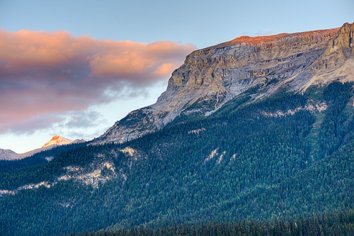
With a trip to Lake O’Hara via the 10:30 AM bus the headliner for Day 6, I chose to remain fairly close to Lake Louise for sunrise so, for the third time this trip and the fifth time over the past two years, I decided to see if I could see light on the Ten Peaks from the Moraine Lake rock pile.
It was bitterly cold this morning–the air temperature was less than 25 degrees (F) as I approached Moraine Lake and I could see clear indications of frost on the side of the road as I made the drive. When I made it up to the rock pile I felt the wind; it was wicked, and blowing right in my face. I would estimate the wind–which killed any chance for any meaningful reflections, regardless of the light–at a steady 25 MPH with gusts approaching 40 MPH.
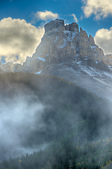
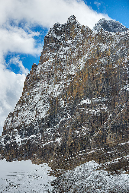
Given the wind, I really shouldn’t have subjected myself to an hour or more up on that rock pile, but for some reason I did. The skies were almost completely clear, so I finally did see first light on the peaks, but despite being prepared for the cold (heavy winter coat on top of multiple layers), it was truly an unpleasant experience. And, with the unceasing wind, it was very difficult to obtain sharp images. With the trees blowing like mad, white caps on Moraine Lake, and my hands frozen, I ultimately settled for some peak portraits, including the one you see below.
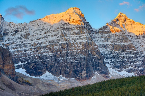
Ten Peaks Sunrise, Banff National Park, Alberta
I descended the rock pile about 30 minutes after the light touched the peaks. Given the strength of the wind, I assumed that it would be fairly windy just about everywhere that day, but when I got down to lake level, it wasn’t bad at all. There was clearly something about the spot at the east end of the lake that turned it into a full-blown wind tunnel on this morning.
After leaving Moraine Lake I made a brief stop on the Bow Valley Parkway at Morant’s Curve, a well-known bend in the tracks of the Canadian Pacific Railroad. A clear view of the tracks and the Bow River highlight the vista.
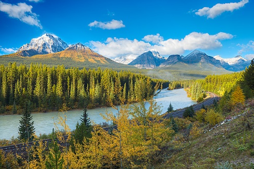
Morant’s Curve, Banff National Park, Alberta
With more than an hour to get to the Lake O’Hara bus loading area, I decided to poke around at a location familiar to me that lies relatively near the depot–the base of the Yoho Valley Road, which I’d examined on Day 2. The aspens on the mountainside there, I estimated, would probably be near peak by now.
As I descended to valley level near the Kicking Horse River, I saw a massive band of fog, clearly produced by the meeting of the cold air and the relatively warm water of the river. This created some fascinating conditions which I hastened to take advantage of. I parked the car in an empty lot just west of the Cathedral Mountain Lodge and wandered around the immediate area, looking for ways to capture the dynamic conditions.
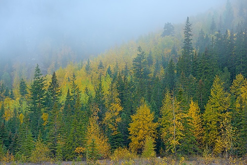
Foggy Aspens, Yoho Valley Road, Yoho National Park, British Columbia
The whimsy of the fog, which lifted and sank like a buoy on ocean swells, revealed certain subjects, then hid them, then displayed them again.
Foggy Trees, Yoho Valley Road, Yoho National Park, British Columbia
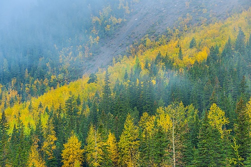
Above the fog, it was a mostly sunny morning, and the sun’s rays had an impact on the mist as it climbed in the sky, particularly to the southeast, in the direction of Cathedral Crags.
Cathedral Crags, Yoho National Park, British Columbia
Below the peaks, in the valley cutouts still lying in deep shade, the wafting mist continued to settle thickly, swirling in and among the trees.
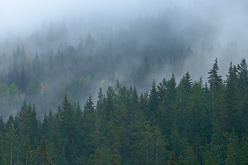
Foggy Trees, Yoho Valley Road, Yoho National Park, British Columbia
Enchanting as the conditions were I could have hung out in this area until the mist burned off completely, but it was mid-morning by now and I couldn’t afford to miss the bus to Lake O’Hara, so I somewhat reluctantly packed up and drove to the O’Hara dispatch area.
Lake O’Hara
Truth be told, by far the single most consequential reason for my return to the Canadian Rockies in the fall of 2015 was my experience at Lake O’Hara the previous year. (For a full account of that debacle, go here.)
As a brief refresher, access to the Lake O’Hara area of Yoho National Park, just across the provincial border in British Columbia, is highly restricted. There’s a daily quota placed on access. The fire road that leads from the parking area to the lake is approximately seven miles long and is uphill the entire way. The number of people who are allowed to hike in each day is unlimited–the hike itself is considered dissuasion enough. There’s a (very expensive) lodge up there (a Parks Canada representative told me that the current rate is $900 (CN) per night, with a two-night stay minimum), a campground with a quota and a few scattered huts that require reservations. A small number of spots for day trippers (like myself) that are driven up to the area on a converted school bus each morning are also available. Last year, I’d secured one day’s access for myself via the antiquated phone reservation system established by Parks Canada.
This year, Parks Canada joined the 20th (if not the 21st) Century by establishing an on-line reservation system. The only problems? Parks Canada opened up every single day for the entire 2015 season (which runs from late June to the first weekend in October) at one time (9 AM, MDT, on April 20). I didn’t learn of this new system until the day it debuted, about two hours after the site went public. At that time, I wasn’t even sure that I was going to return to the Rockies this year. By the time I was made aware of the site and checked it out, virtually the entire season was already sold out. In a near panic, I managed to nab the final single spot on the 10:30 AM bus (the other departure time, 8:30 AM, was already completely sold out for every day in September) on three days–Sept. 21, 22 and 25. By the time I had secured these spots, there were no more day trip access spots for any of the days in the month of September (the time I’d be going to the Rockies, if I went at all). June, July and August were already gone before I even knew that the website existed; all that remained were a handful of spots on the final weekend of the season, in early October.
As problematic as the reservation experience had been, I’d managed, somehow, to satisfy my basic goal: obtain multiple days’ access to Lake O’Hara. (Had I not secured multi-day access to Lake O’Hara, I probably wouldn’t have returned to the Canadian Rockies in 2015.) My previous trip had proven how important this would be–the weather up there is not only highly variable, but often very, very wet, even in the fall (the driest time of the year). Despite what the cheery Parks Canada docents who serve as the lake’s liaisons to the public say, every day at Lake O’Hara is not necessarily a good one. I’m here to tell you, in fact, that a rainy day at Lake O’Hara is a pretty damn crappy experience. I had already determined that I wouldn’t even bother showing up at the bus departure area on a rainy day this time around; multiple days’ worth of reservations made it possible to adopt this attitude.
But, after five straight days of cloudy (and occasionally) rainy days in the region, this day–my first day of access to O’Hara–was forecast to be mostly sunny with zero chance of precipitation. It appeared that I would have the opportunity to experience the area in something other than rainy conditions.
On the ride up to the lake I kept looking out the bus window to be sure; the sun was indeed out on the trip up to O’Hara. It was still pretty cold, but getting warmer when the bus pulled up adjacent to the Le Relais Day Shelter. I immediately hit the trail to begin my hike up to the Opabin Plateau and took in the beautiful wonder of Lake O’Hara and the surrounding peaks on this gorgeous sunny day. Just before ascending to the Opabin Plateau via the East Opabin Trail, I reached the gushing outlet stream that drains the plateau’s waterways into Lake O’Hara from hundreds of feet above. The cascade remained entirely in shade, so I stopped to make an image.
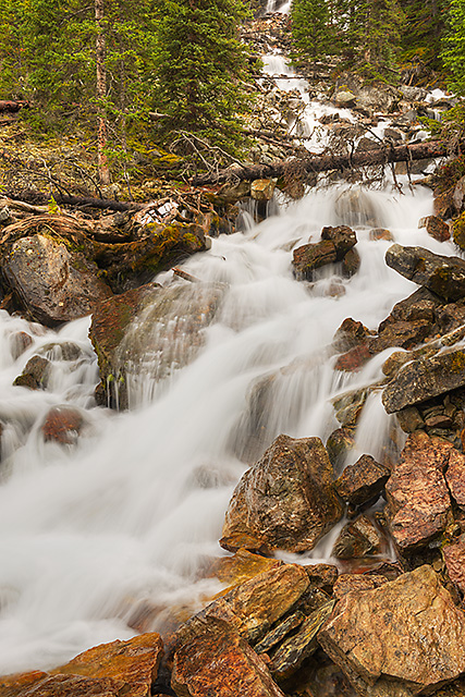
Opabin Plateau Outlet Stream, Yoho National Park, British Columbia
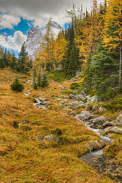
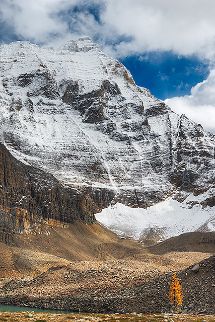
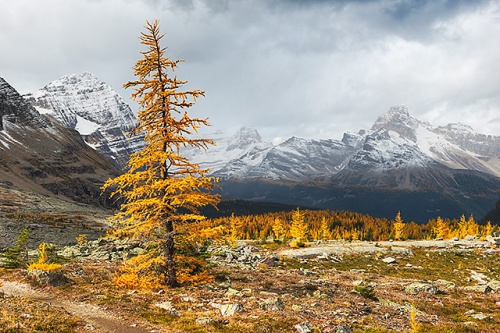
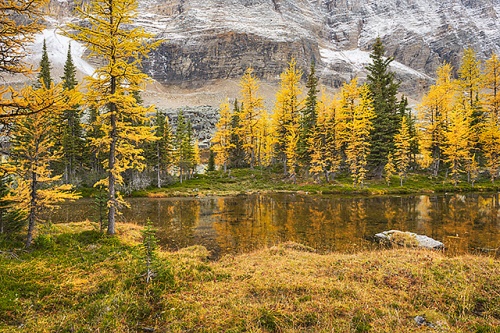
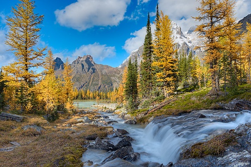
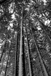
The East Opabin Trail is an extremely steep ascent through a conifer forest that climbs roughly 400 feet to the hanging valley that is the Opabin Plateau. Emerging from the pine forest one spots the first larch trees that, at this time of the year, turn bright gold. The larches were at absolute peak when I was in the area and I spotted them along the sides of a rushing stream.
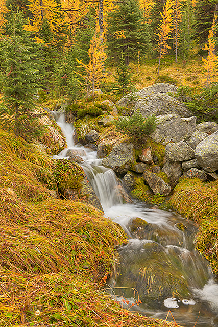
Opabin Cascade, East Opabin Trail, Opabin Plateau, Yoho National Park, British Columbia
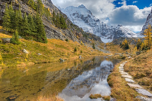
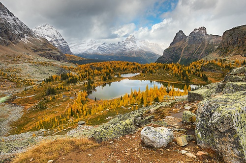
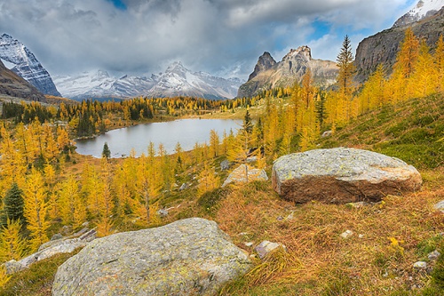
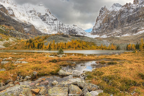
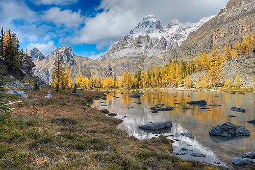
At the foot of the plateau the terrain opens up to a series of meadows and small, pristine ponds and lakes bordered by the talus slopes of the nearby peaks.
East Opabin Trail, Opabin Plateau, Yoho National Park, British Columbia
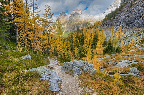
East Opabin Trail, Opabin Plateau, Yoho National Park, British Columbia
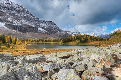
Opabin Plateau, Yoho National Park, British Columbia
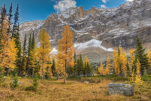
As it had been raining steadily on my previous visit to this area, I took extra time to look around and really absorb the incredible, breathtaking beauty of the place.
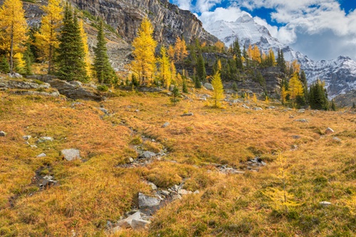
Opabin Plateau, Yoho National Park, British Columbia
Moor Lakes Reflections, Opabin Plateau, Yoho National Park, British Columbia
I stopped frequently to photograph, and slowly made my way astride Hungabee Lake.
Hungabee Lake, Opabin Plateau, Yoho National Park, British Columbia
As I slowly made my way up the moraine that contains the trail up to Opabin Lake, the mid-point of the Opabin Circuit, I turned and looked behind me…and saw–contrary to the day’s forecast–what appeared to be a snow squall blowing in from the west.
By the time I reached Opabin Lake, it had started to snow. It was falling in the form of pellets, rather than flakes, but it was coming down hard. The ground was too warm for it to stick, fortunately, but I was left, again, to shake my head at the incredibly unpredictable mountain weather.
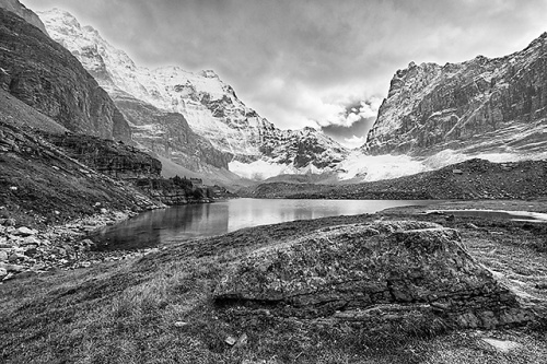
Opabin Lake Black & White, Opabin Plateau, Yoho National Park, British Columbia
Hungabee Mountain, Opabin Plateau, Yoho National Park, British Columbia
Given the pellet nature of the snowfall, it was pretty dry–not at all like my experience with the non-stop rain the previous year. Given the forecast for the day, I couldn’t imagine that the squall would last long, so I decided to wait it out up on the plateau. Given my experience the previous year I’m not sure where my confidence came from, but I felt strongly that the snowstorm would blow over before too long. I even produced a few images while the snow was falling. Remarkably, there was one section of sky, to the southeast, that never clouded over, even when the mountain peaks back in the direction of Lake O’Hara were completely obscured by the storm.
Mt. Biddle, Opabin Plateau, Yoho National Park, British Columbia
It’s impossible to tell at this size, but when I look at the above image at 100% on my computer monitor I can see the falling “snowflakes” backed by the blue sky.
Yukness and Hungabee Mountains Black & White, Opabin Plateau, Yoho National Park, British Columbia
The snow lasted, off and on, for about 45 minutes, but well before it stopped I could see a clearing sky to the west. Once the clearing conditions reached the plateau, the weather was nothing short of outstanding for the rest of the day–the wind dropped and the sky was partly cloudy.
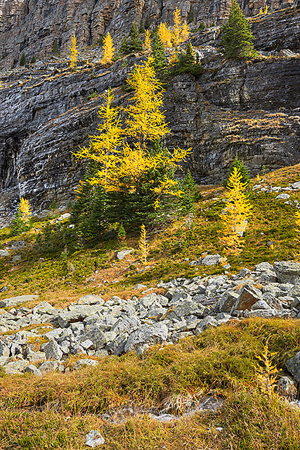
Lone Larch, Opabin Plateau, Yoho National Park, British Columbia
I slowly worked my way back in the direction of the descent toward Lake O’Hara, shooting first around Hungabee Lake.
Hungabee Lake and Cascade Lakes, Opabin Plateau, Yoho National Park, British Columbia
Hungabee Lake, Opabin Plateau, Yoho National Park, British Columbia
After descending from the layer of the plateau that includes Opabin Lake, I rounded Hungabee Lake and wandered around the small series of ponds that make up the Cascade Lakes.
Hungabee Lake, Opabin Plateau, Yoho National Park, British Columbia
Cascade Lakes, Opabin Plateau, Yoho National Park, British Columbia
Schaffer Ridge, Opabin Plateau, Yoho National Park, British Columbia
Cascade Lakes, Opabin Plateau, Yoho National Park, British Columbia
Gradually, I reached the spot where Hungabee Lake drains into the small series of Cascade Lakes, via an extremely photogenic outlet stream. The outlet stream includes a small waterfall. I had photographed at this location in the rain the previous year, but this time I had better conditions and took the time to carefully lay out a couple of compositions.
Hungabee Lake Outlet Stream, Opabin Plateau, Yoho National Park, British Columbia
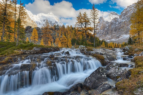
Hungabee Lake Outlet Stream, Opabin Plateau, Yoho National Park, British Columbia
It was getting late at this point–it was after 5 PM. The last daily outgoing bus that departs from down at the Le Relais Shelter leaves promptly at 6:30. If you’re at the Lake O’Hara area on a day pass, you’re in big trouble if you miss that bus. I had to decide whether to take the time to photograph at the Opabin Prospect before descending the West Opabin Trail to Lake O’Hara. I had to leave roughly 30 minutes to get back to Le Relais from the top of the West Opabin Trail. The safest move, probably, was to wait until the next day to photograph at the Prospect, but the conditions were so nice at that moment that I decided to risk making my way to the cliff overhang (I’d been there the previous year so I knew the rough route), photograph there briefly, and then descend back to Lake O’Hara. My thinking was, what if the next day’s conditions weren’t so good? I might never get conditions like these again. You just never know in this area. The forecast for the next day was dry and mostly sunny, but that had been today’s forecast as well and it hadn’t turned out to be quite so simple. I decided to take advantage of the situation while it was right in front of me.
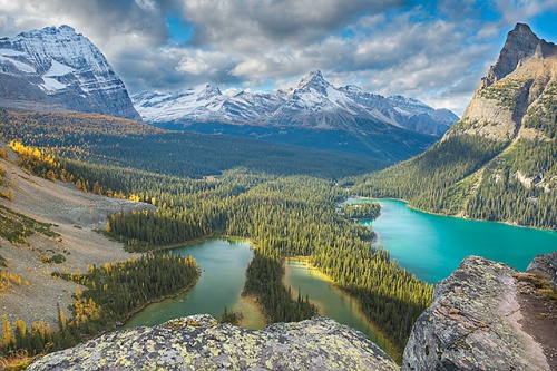
Mary Lake and Lake O’Hara from the Opabin Prospect, Yoho National Park, British Columbia

Mary Lake and Lake O’Hara from the Opabin Prospect, Yoho National Park, British Columbia
When I finished at the Opabin Prospect, I knew I had to hustle, and the West Opabin Trail…let’s just say that it’s not really conducive to speed. The descent is quite steep and the footing is only so-so. That precariousness was especially true this day, because the trail was icy. Even though the temperature had risen into the 50s (F), this area had been in the shade all day long and evidently the ice was thick enough that it hadn’t yet completely melted.
To make matters more difficult, the views on various parts of the West Opabin descent are absolutely magnificent. With more time on my hands, I would have stopped numerous times to photograph. That would have to wait until the next day–hopefully.
I moved as quickly as I felt I could and I made it down and back to Le Relais about 10 minutes before the bus left.
The Remains of the Day
It was about 40 minutes until sunset when the bus reached the O’Hara parking lot and I decided to try to make the most of it. The nearest spot that made for a good sunset location was Emerald Lake–the site of Day 1‘s sunset shoot.
It was about a 25-minute drive to Emerald Lake, and I got stuck behind a slowpoke driver, so it took me closer to 30 minutes to get there. I made a beeline to the nearest area of lake shore to the parking lot and quickly set up. The Day 1 experience saved me the trouble of wasting the good light while searching for good spots.
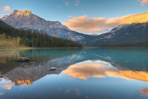
Emerald Lake at Sunset, Yoho National Park, British Columbia
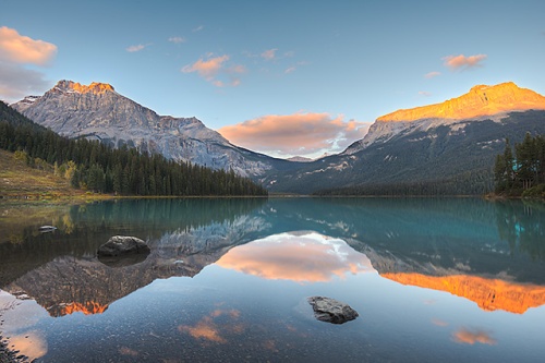
Emerald Lake at Sunset, Yoho National Park, British Columbia
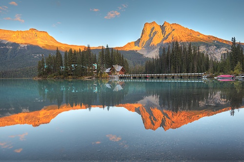
Emerald Lake Lodge at Sunset, Yoho National Park, British Columbia
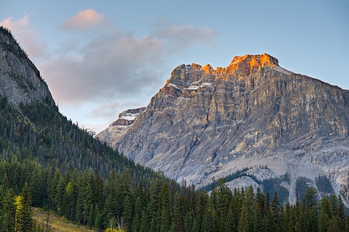
Michael Peak at Sunset from Emerald Lake, Yoho National Park, British Columbia
Wapta Mountain at Sunset from Emerald Lake, Yoho National Park, British Columbia
When I lost the light at the lake, I packed up, returned to the parking lot, and left. But on the Emerald Lake Road I caught a glimpse of a distant landscape, pulled off to the side of the road, pulled out my telephoto rig and composed the final shot of the day amid earthshadow dusk.
Yoho Peaks at Dusk from the Emerald Lake Road, Yoho National Park, British Columbia
And with that, I got back in the car and made the 30-odd minute drive back to Lake Louise.
It had been an immensely satisfying day–most particularly because of my experience at Lake O’Hara, which involved scratching an itch that had been festering for a year. The best part was, it appeared that I’d continue to have the chance to keep scratching the next day when I returned to Lake O’Hara; even better weather was in store.


A very nice collection of photographs!
By: centralohionature on December 1, 2015
at 11:04 am
Thanks!
By: kerryl29 on December 2, 2015
at 11:44 am
All of these images are just incredibly beautiful. I particularly like the ones of the Hungabee Lake outlet stream as I didn’t see that when I was at Lake O’Hara (hmmm…how did I miss that?). And the shots of sunset at Emerald Lake are stunning.
By: EllenK on December 1, 2015
at 11:23 am
Thanks, Ellen. You won’t see the outlet stream if you remain on the primary Opabin Circuit trail. Taking the circuit in a clockwise direction, after you descend from the top tier of the plateau (i.e. the area including Opabin Lake), you skirt the west side of Hungabee Lake. When you reach what is roughly the southwest edge of Hungabee, you see the first of a series of what I’ll call secondary trails that crisscross the northern half of the plateau and interweave in and around the various Cascade and Moor Lakes. The outlet stream can be seen by following one of these secondary trails, one that more or less parallels the main Opabin Circuit trail and lies to the east of the main circuit. It’s kind of maddening because many–if not most–of the secondary trails don’t appear on the official Lake O’Hara hiking map.
By: kerryl29 on December 2, 2015
at 11:53 am
An amazing walk through such a truly gorgeous part of the world…Loved your photos.
By: Charlie@Seattle Trekker on December 1, 2015
at 1:10 pm
Thanks very much!
By: kerryl29 on December 2, 2015
at 11:53 am
Wow, these pics from above Lake O’Hara are gorgeous (ok, all of them are, actually). Well done!
By: Samuel on December 1, 2015
at 3:12 pm
Thank you!
By: kerryl29 on December 2, 2015
at 11:54 am
Very nice set of images and fantastic mountain landscape there!
By: gtonthenet on December 2, 2015
at 9:40 am
Thanks!
By: kerryl29 on December 2, 2015
at 11:54 am
Oh my goodness, I could so relate to “should I stop and take this photo?” vs. “maybe I will wait until later” (I have missed some great shots with the latter thinking) I hear the saying”if you don’t like the weather, just wait 10 minutes.” often, but in the mountains, it is a literal description.You made a great choice-what beautiful colours with the larches, and light, especially in the first O’Hara image.Also love the reflecting waters. The combination of sky and cloud worked well for you.And you went back…Whoo Hoo! I am excited to see the results.A question, do you take the bus then still have to hike in to see O’Hara? How far?
By: Janes Heartsong on December 2, 2015
at 10:44 am
Thanks, Jane.
You’re right; in the Chicago area I often hear the “if you don’t like the weather here just wait a minute” line, but it’s nothing like what can–and often does–happen in the mountains. (I had another experience with a completely unexpected–and much heavier–snowfall later in the trip, along the Icefields Parkway a bit south of Icefields Centre.)
Re the bus…the drop-off spot is at the Le Relais day shelter, on the northwest edge of Lake O’Hara. It’s about a 30-second walk from that spot to get a nice, wide view of Lake O’Hara. There’s a Lake O’Hara circuit trail (it circles the lake, as you might imagine) that is, by far, the easiest hiking trail in the O’Hara area. There’s minimal elevation change and the hike is about 1.5 miles (roughly 2.3 km). This is also the point of access for a number of other (much longer and far more strenuous) hikes, including the Opabin Plateau, Lake Oesa, Yukness and Huber Ledges, etc.
By: kerryl29 on December 2, 2015
at 12:01 pm
Many thanks!
By: Janes Heartsong on December 2, 2015
at 2:01 pm
Sorry that I’m late commenting again. I’ve viewed this post several times, stunned by the natural beauty of the Canadian Rockies and your ability to bring it to life through your images! I don’t know what else to say without sounding like a broken record.
By: quietsolopursuits on December 8, 2015
at 1:45 pm
No apology necessary, believe me–thanks for taking the time to comment.
By: kerryl29 on December 9, 2015
at 10:14 am
[…] sunny, all day long, no chance of precipitation (though my experience up at the Opabin Plateau on Day 6 made that more than a bit dubious) and temperatures expected to rise into the 50s (F). To top […]
By: Canadian Rockies Day 7: Scratching the Itch, Part II | Lightscapes Nature Photography Blog on December 15, 2015
at 9:44 am
[…] I’ve outlined in my descriptions of Day 6 and Day 7, I had some truly terrific weather for much of the first day and all of the second, which […]
By: Canadian Rockies Thematic Interruption: Lake O’Hara – A Retrospective | Lightscapes Nature Photography Blog on December 29, 2015
at 9:26 am
[…] that morning killed any chance at reflections. Conditions were calm at Emerald Lake at sunset on Day 6, but the skies were only so-so. The experience was similar at sunset on Day 1, when the light […]
By: The Canadian Rockies, Day 8: From Dawn ‘Til Dusk | Lightscapes Nature Photography Blog on January 4, 2016
at 8:06 am
[…] and can change in a flash. (Consider the utterly unpredicted snow squall that I dealt with on Day 6.) Dress in breathable layers and be prepared for inclement weather. I always keep a collapsible […]
By: Lake O’Hara – Hiking Options and Planning Considerations | Lightscapes Nature Photography Blog on January 11, 2016
at 10:00 am
[…] reserved access to the Lake O’Hara area. Given the success I’d experienced on Days 6 and 7 on the Opabin Plateau, I’d planned to spend Day 10 making the hike from O’Hara […]
By: Canadian Rockies Day 10: Down Time | Lightscapes Nature Photography Blog on January 26, 2016
at 9:12 am
[…] https://lightscapesphotography.wordpress.com/2015/12/01/canadian-rockies-day-6-scratching-the-itch-p… […]
By: A Bridge | Lightscapes Nature Photography Blog on October 14, 2016
at 8:12 am
[…] https://lightscapesphotography.wordpress.com/2015/12/01/canadian-rockies-day-6-scratching-the-itch-p… […]
By: Favorite Trails for Photography, Part I | Lightscapes Nature Photography Blog on July 30, 2018
at 8:44 am
[…] to the Canadian Rockies the following year and three more visits to the Lake O’Hara area, two of which included far nicer weather and immeasurably better […]
By: The Story Behind the Image: Opabin Plateau | Lightscapes Nature Photography Blog on January 23, 2023
at 8:00 am