A few months ago, I posted an entry entitled Hiking and Photography. That post, in which I made the case for going to the trouble of hiking to enable one’s photography despite the…well, trouble of doing so, has received a lot of traffic since it went live in March. As a follow up I decided to produce a series of posts outlining some of my favorite “photographic trails.”
What this Is and What it Isn’t
This isn’t meant to represent a be-all, end-all list, even for me personally. These are just some of my favorites; there are undoubtedly great trails I haven’t yet experienced. There are certainly others that I have hiked that I think are good but won’t be included for one reason or another. And I should add that the focus is on trails that have a lot of photo opportunities along the way, as opposed to trails one takes primarily or exclusively to reach a great photo destination (e.g. hiking to an overlook or a waterfall or a beach, etc.). Perhaps that could represent a future series. Hmmm…
That covers the rough, informal criteria for the list–which, not incidentally, is presented in no particular order. This is not a comparative ranking of photo hikes–merely a presentation of some of my favorites. In my opinion, all of these trails are conducive to exceptional photography under appropriate conditions. So, without further adieu…
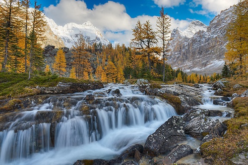
Trail of Ten Falls, Silver Falls State Park, Oregon

South Falls, Silver Falls State Park, Oregon
A long loop trail that can be done in a single hike or in segments, the Trail of Ten Falls, located in Silver Falls State Park (about 40 minutes east of Salem, Oregon) is just under nine miles for the entire circuit. In addition to the waterfalls–surprise, there are ten of them–there are numerous cascades on Silver Creek that are photogenic, in addition to moss-draped broad-tooth maple trees and numerous wildflowers (in spring and summer) that will capture your attention. And, given the winding nature of the trails, most of the waterfalls have numerous perspectives you can explore without violating park guidelines to stay on the trails.
It’s possible to walk behind three or four of these waterfalls, which adds to the compositional possibilities, and there are at least a few photogenic bridges (not to mention stone walls and wooden fences) that can be effectively utilized in some of your images.

Lower South Falls Black & White, Silver Falls State Park, Oregon
The park sees a fair amount of traffic, but if you can time your visit for a weekday not during the summer months, and particularly if you can get out early and/or stay late, you shouldn’t run into serious problems with crowds. I’d recommend visiting in the spring (pick a cloudy day, regardless of season), when all the waterfalls are typically flowing nicely, the trees have leafed out and the wildflowers are plentiful.
Some links to posts covering this trail:
https://lightscapesphotography.wordpress.com/2015/09/14/day-12-the-trail-of-ten-falls/

Lower North Falls, Silver Falls State Park, Oregon
Auxier Ridge Trail, Red River Gorge, Daniel Boone National Forest, Kentucky

Auxier Ridge Sunset, Red River Gorge, Daniel Boone National Forest, Kentucky
There are a plethora of interesting trails in and around the Red River Gorge and the nearby Natural Bridge State Park in eastern Kentucky, but the Auxier Ridge Trail, within the confines of the Daniel Boone National Forest, is my favorite. I hiked this trail at least four separate times during the week I spent in the area a number of years ago and even when I didn’t have my photo gear with me I enjoyed the experience.
While it can be turned into a loop by intersecting with other trails, the Auxier Ridge Trail itself is about a 4 1/2 mile out and back. There are some really impressive views from numerous spots along the trail–including sightings of several natural arches. The trail also winds through some interesting mixed forest settings along the way.

Forest Floor, Auxier Ridge Trail, Red River Gorge, Daniel Boone National Forest, Kentucky
There’s a fair amount of up and down on this trail, but none of it is particularly difficult. Best times are in the spring–I’d say mid- to late April is ideal–and in the fall (late October). There are a number of spots that work well as sunrise and/or sunset locations as good views can be had in all directions at various spots along the trail, but be sure to bring a flashlight or headlamp if you plan to photograph under those circumstances.

Ridge Lines, Auxier Ridge Trail, Red River Gorge, Daniel Boone National Forest, Kentucky
Gorge Trail, Watkins Glen State Park, New York

Rainbow Falls, Watkins Glen State Park, New York
The Gorge Trail at Watkins Glen State Park is a paved route of about 1 1/4 miles (2 1/2 miles out and back), featuring 800 concrete steps that provide some phenomenal views of 19 waterfalls and countless cascades that tumble through the deep, narrow crevice. Because of the ice that forms in the winter months and the rarity of sunlight penetrating the gorge at that time of the year the trail is only accessible from mid-May until early November.
The trail is very popular; even on weekdays in the non-summer months that the Gorge Trail is accessible the place is teeming with people during the “usual” tourist hours. But since the scenes effectively demand even light for photography, you don’t want to be there in the middle of the day anyway. Get there at (or slightly before) first light and you will blissfully have the place to yourself–ideal for getting the perfect perspective. Getting those ideal spots is next to impossible when it’s crowded so the only point to visiting at or near the middle of the day is for scouting purposes.

Cavern Cascade, Watkins Glen State Park, New York
A tripod is a must; it always is, but it’s especially a must, if that makes any sense, given the subject matter (moving water) and the inherently long shutter speeds given how dark it is in the gorge at the edges of the day.
Be prepared to get a bit damp as you clear Rainbow Falls. And if you have to go on a blue sky day, with a bit of luck (and planning) you may be able to experience (and photograph) the ethereal glow that reflected sunlight can emit to the stone walls–natural and man made. Regardless, this is a location not to be missed.

Minnehaha Falls and Cavern Cascade, Watkins Glen State Park, New York
Some links to posts covering this trail:
https://lightscapesphotography.wordpress.com/2016/07/18/the-finger-lakes-schuyler-tompkins-counties/
https://lightscapesphotography.wordpress.com/2016/07/27/the-finger-lakes-blue-sky-scouting/
Opabin Circuit Trail, Yoho National Park, British Columbia
Hungabee Lake Outlet Stream, Opabin Plateau, Yoho National Park, British Columbia
Among the most beautiful places I’ve ever set my eyes on, the Opabin Plateau, hundreds of feet above the valley that contains Lake O’Hara, can be explored via the Opabin Circuit Trail, which begins on the shores of the aforementioned lake before steeply climbing to the plateau itself. I’ve described this hike at great length in a piece posted several years ago and rather than repeat myself I’ll simply direct you there. Suffice to say that, if you get good weather and can work within the access limitations, the Opabin Circuit should be near the top of any landscape photographer’s wish list. If you can time your visit during the period during the back half of September when the larches turn gold you’ll have all the elements for an unforgettable experience.

Mary Lake and Cathedral Mountain from the West Opabin Trail, Yoho National Park, British Columbia
The Opabin Circuit itself is (roughly) a five-mile loop, most of which isn’t strenuous but the parts that are can be challenging if you aren’t in good shape. It’s also worth noting that there’s essentially no shelter of any kind along the trail so if the weather turns bad–and, believe me, it does so frequently–you have to be prepared to absorb whatever Mother Nature throws at you. It’s also worth noting that there are so many side routes worth exploring once atop the Opabin Plateau that you’re going to end up hiking a lot more than five miles, though you’ll be so entranced you probably won’t notice….much.
Suffice to say, I don’t believe I have ever photographed along any trail, before or since, as much as I did on the Opabin Circuit.

Hungabee Lake and Cathedral Mountain, Opabin Plateau, Yoho National Park, British Columbia
Some links to posts covering this trail:
https://lightscapesphotography.wordpress.com/2014/10/21/the-canadian-rockies-day-two-lake-ohara/
Virgin River Narrows, Zion National Park, Utah

Virgin River Narrows, Zion National Park, Utah
This isn’t a trail in the conventional sense because the “trail” is really the river bed. The length of this “trail” is variable, depending on conditions and how much you want to do. I did about a 5-mile out and back, turning around when the sun was playing havoc with my photography opportunities and when the water level (I was there in May, when the river is deep and rushing) threatened to reach shoulder height.
But the experience of hiking the Narrows is like nothing I’ve ever had before or since. Since I was there when the winter melt off was doing its thing, most of the hike was in water up to (or slightly above) waist level. At later times of the year–summer into fall–there’s much less water to deal with, which is better for hiking, certainly, but probably isn’t nearly as photogenic.

Virgin River Narrows, Zion National Park, Utah
Visitation levels at Zion have exploded in the last few years and this is among the most popular hikes in the park, so I’m not sure what to tell anyone about best times other than to get there as early as possible–you absolutely must be on the first bus up canyon–and to avoid weekends (and the summer in general) like the plague. Hiking the Narrows in the spring, as I did, is both rewarding and challenging but you have to be prepared to deal with the current and the fact that you’re going to experience water levels at least up to your waist. There are definite advantages to going at this time of the year, but there are problems that must be overcome as well (dry bags, anyone?).
In any case, if the opportunity presents itself to do this hike when the Narrows isn’t inundated with zillions of people, by all means do so.

Virgin River Narrows, Zion National Park, Utah
Some links to posts covering this trail:
https://lightscapesphotography.wordpress.com/2012/06/05/day-4-the-narrows/
https://1001scribbles.com/2012/05/31/thursday-tips-be-prepared
I’ll present another installment of my favorite photo trails next time.


I can definitely second the motion for Silver Falls State Park and the Opabin Plateau. And I like your description of how you selected hikes for inclusion (hikes with photographic opportunities all along the way rather than destination hikes). For those of us who can’t keep up with the jackrabbits, the excuse to stop and shoot makes the hiking more enjoyable.
By: EllenK on July 30, 2018
at 9:01 am
Thanks, Ellen. Without question, the best photo trails are the ones with greatest number of opportunities.
By: kerryl29 on July 30, 2018
at 11:14 am
Great list! I happen to live within an hour’s drive of the Red River Gorge and have been on the Auxier Ridge Trail myself several times. I love it! I’ve also been on the Watkins Glen State Park trail and enjoyed it immensely, too. I’d love to try some of the others you have mentioned here and will look forward to see what’s in your next post on this topic!
By: ChildOfGrace10142001 on July 30, 2018
at 3:27 pm
Thanks! It’s about a four-hour one-way drive to the RRG for me, but I really should get back there one of these days.
By: kerryl29 on July 30, 2018
at 4:28 pm
Yes, it’s worth the drive. 🙂
By: ChildOfGrace10142001 on July 30, 2018
at 7:13 pm
Wow! I can see why these are some of your favourites and you certainly show them in their best light. I would love to get back to Yoho and see Lake O’Hara and Mary Lake which I missed the last time and would love to see the other ones if the money allows for the travel. For now I will vicariously live through your images.
By: Jane's Heartsong on July 30, 2018
at 11:08 pm
Thanks, Jane. The Lake O’Hara/Opabin area is great, of course, if you can secure access and experience good weather. The other locations in this entry are all a long, long way from where you are but before this series concludes I’ll have at least one more trail that’s closer to your neck of the woods. 🙂
By: kerryl29 on July 31, 2018
at 11:39 am
Kerry, what a treat to see your pick of the best! I still remember the Hungabee Lake and Cathedral Mountain photo, as well as the shots from Zion National Park. I will not likely ever get to visit these sites in person, so seeing them through your eyes is a priceless treasure. Thank you for sharing your vision and your boundless gift.
By: composerinthegarden on July 31, 2018
at 3:58 pm
Thanks Lynn; that’s extremely kind of you to say.
By: kerryl29 on July 31, 2018
at 5:35 pm
I’m heading to Oregon in November and will definitely check out the Trail of 10 Falls – thanks!
By: Matthew Mahavongtrakul on August 5, 2018
at 6:44 pm
Good deal! As long as it hasn’t been an excessively dry fall up to the time of your visit Silver Falls State Park should be well worth your time.
By: kerryl29 on August 5, 2018
at 7:37 pm
[…] the criteria for inclusion as well as a set of five of my favorites–you can check it out here. A general entry about hiking and photography, which led to the current series of posts, is […]
By: Favorite Trails for Photography, Part II | Lightscapes Nature Photography Blog on August 6, 2018
at 8:25 am
[…] Favorite Trails for Photography Part I […]
By: Favorite Trails for Photography Part III | Lightscapes Nature Photography Blog on August 13, 2018
at 9:02 am